draft
Natural Environment / 自然環境
Overview / 概要
This page collects what is known of Sagishima's living landscape: its vegetation, water, soils, and the marks of how human cultivation and abandonment have shaped them, drawing on the local histories and on firsthand field notes. The island's documented environmental history runs from a thickly forested past, through the deforestation driven by sweet-potato farming and salt-making, to postwar erosion control and reforestation. For a firsthand field record, see the North-Sunoue transect.
このページは、佐木島の生きた景観について知られていること、すなわち植生・水・土壌と、人の耕作と放棄がそれらをどう形づくってきたかの痕跡を、郷土史と現地の野帳に基づいて集めるものである。島の記録された自然環境の歴史は、樹木の茂る過去から、さつまいも栽培と製塩による森林の消失を経て、戦後の砂防と植林へと至る。現地での記録については、須ノ上北側の踏査を参照。
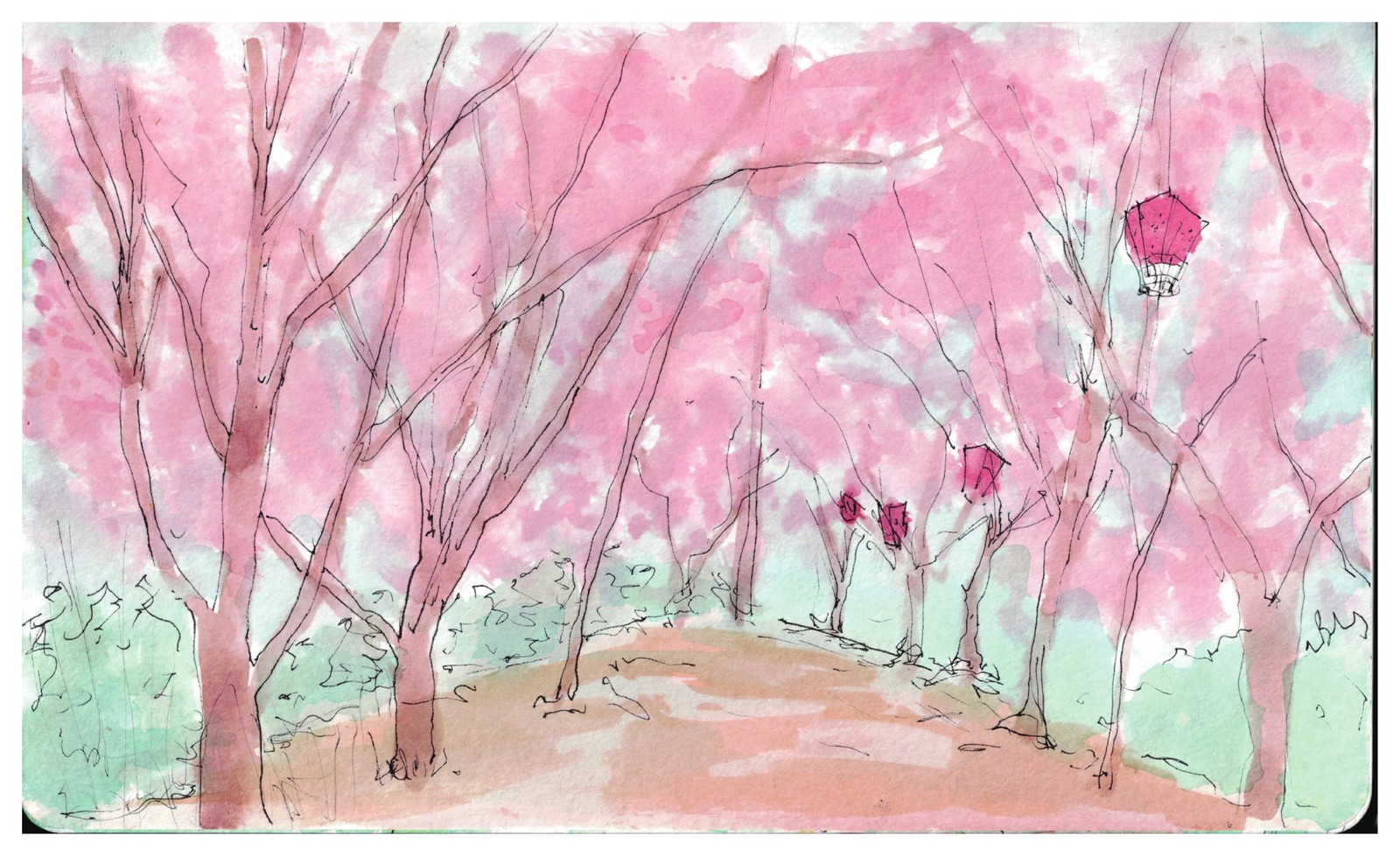
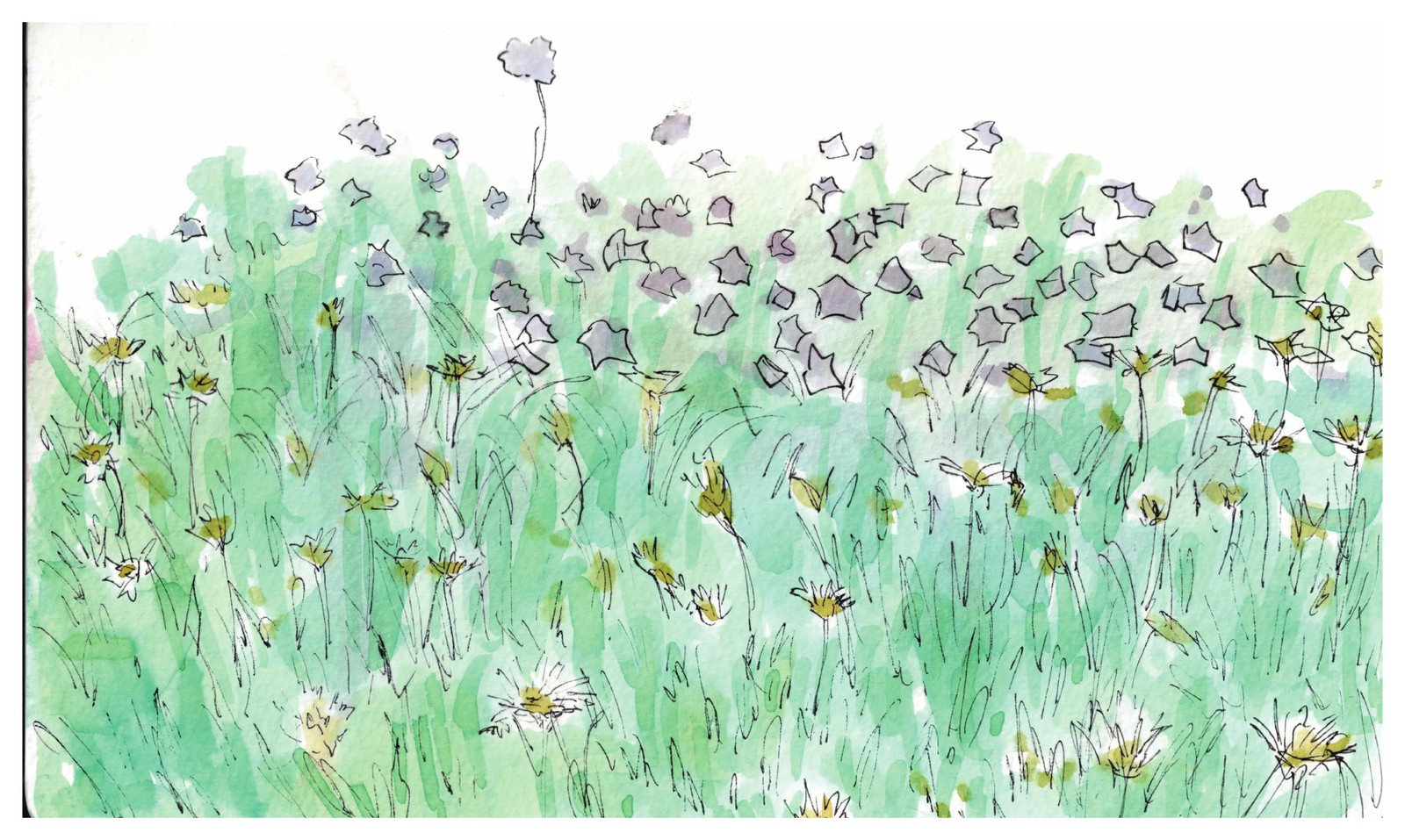
The Red Dot School's Square group painted the island in season in a set of 2026 watercolors.
レッドドットスクールのSquareグループは、2026年の一連の水彩画で、季節のなかの島を描いた。
A forested island made bald: the deforestation history / 緑の島がはげ山になるまで
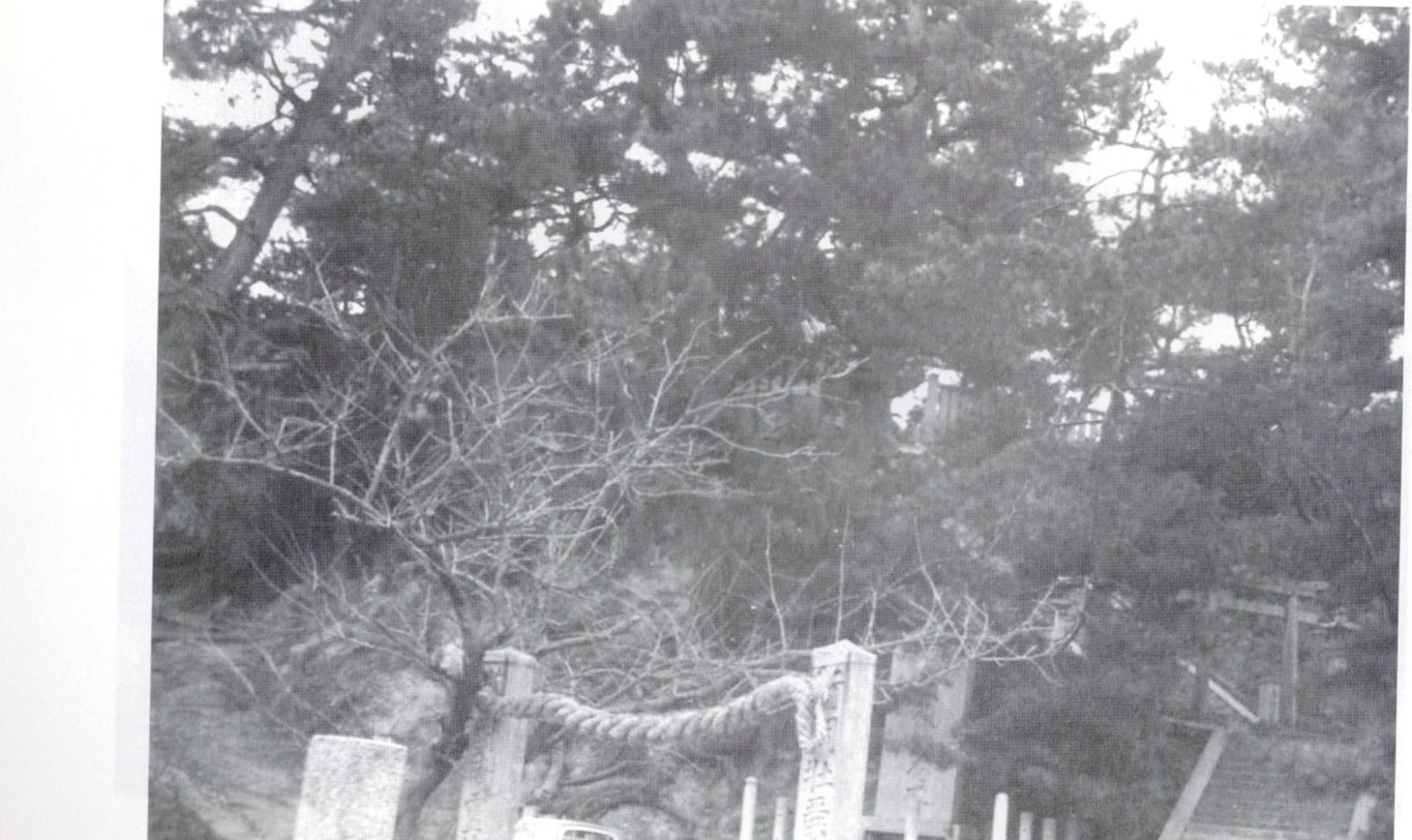
In ancient times Sagishima (佐木島) is said to have been thickly wooded, and its mountains carried pine forest rather than the bare slopes seen today. As late as around 1955 (Shōwa 30), large trees still surrounded the shrine, as preserved in old photographs. Old land records list categories of protected forest such as 御建山 (Otate-yama, domain-reserved forest; reading TENTATIVE) and 御留山 (Otome-yama, cutting-prohibited forest; reading TENTATIVE), evidence that the island's mountains were once forested, not barren (さぎしま讃歌 p.10).
古くは佐木島は樹木の茂る島であったと言われ、その山々は今日見られる裸の斜面ではなく松林を抱えていた。一九五五年(昭和三〇年)ごろまでは、古い写真に残るとおり、神社のまわりにはなお大木が立っていた。古い土地の記録には、御建山(おたてやま。読みは暫定)や御留山(おとめやま。読みは暫定)といった保護林の区分が見え、島の山々がかつては不毛ではなく森に覆われていたことを示している(さぎしま讃歌 p.10)。
The mountains went bald (はげ山, hageyama) for three reasons: the spread of sweet potatoes, which grow well on wasteland and drove the clearing of the hills; the cutting of trees for household firewood; and, from the Tenpō era onward, the rise of salt production, which required tree-felling for fuel (さぎしま讃歌 p.11). The same account is given elsewhere: once arable land and salt fields were opened, mountain trees were cut to fire the salt, and the once-wooded island became bald mountain (はげ山) (さぎしま讃歌 p.46). This was the regional pattern across the Seto Inland Sea, where islands had little flat farmland and were cultivated up the slopes ("cultivating to the sky"); on islands with salt fields the hills grew barer still, and Sagishima too was farmed nearly to its summits (双鷺洲 p.254).
山々がはげ山になったのには三つの理由がある。荒れ地にもよく育つさつまいもの普及が山の伐り開きを進めたこと、家庭の薪のために木が伐られたこと、そして天保のころからの塩づくりの隆盛が燃料用の伐木を要したことである(さぎしま讃歌 p.11)。同じことが別の箇所でも語られており、耕地と塩田が開かれると塩を焚くために山の木が伐られ、かつて木の茂っていた島ははげ山になったという(さぎしま讃歌 p.46)。これは瀬戸内海一帯の型でもあり、島々には平地の農地が乏しく斜面を上へと耕した(「天まで耕す」)。塩田のある島では山はいっそう裸になり、佐木島もまた頂近くまで耕された(双鷺洲 p.254)。
Granite soil and the runoff problem / 花崗岩の土と土砂流失
The island's bedrock and surface soil are granite (花崗岩, kakōgan) and its decomposed, weathered soil (崩壊土). When it rained, the bare mountain surface suffered severe soil and sand runoff (土砂の流失) (さぎしま讃歌 p.46). This was Sagishima's greatest affliction: the sandy surface of granite and its collapse soil crumbles at a finger's touch and holds little water or fertilizer, so rain-beaten sloped fields were the worst danger as fertile topsoil washed away (双鷺洲 p.248-249). This matches the dry, low-organic hill soils recorded in the North-Sunoue transect, where the stream bed and the bamboo duff were the only moist, rich exceptions.
島の岩盤と表土は花崗岩(かこうがん)とその崩壊土(風化土)である。雨が降ると、裸の山肌は激しい土砂の流失に見舞われた(さぎしま讃歌 p.46)。これは佐木島最大の悩みであった。花崗岩の砂質の表面とその崩壊土は指で触れただけで崩れ、水も肥料もほとんど保たないため、雨に打たれる傾斜畑が最も危うく、肥えた表土が流れ去った(双鷺洲 p.248-249)。これは、須ノ上北側の踏査で記録された乾いて有機物の乏しい丘の土壌とよく一致し、谷底と竹林の落ち葉の層だけが湿って豊かな例外であった。
Seto Inland Sea rainfall concentrates in June and July and in the September typhoon season. The rainy season coincided with the barley-to-sweet-potato changeover, when fields were often bare, worsening erosion, especially on the island's west side. People built stone walls and sandbag levees along the erosion gullies, but fields still washed away (双鷺洲 p.249). To enrich the poor granitic soil and curb runoff, much organic matter was needed: mountain grass, fallen leaves, and straw trodden by cattle were composted, and rice straw, barley straw, pyrethrum stalks, and sweet-potato stalks were mixed with manure. Because the mountains had been stripped bare by tree-felling for salt-making and farmland, sea algae (藻, mo) was also gathered for fertilizer; it decomposed well in the granitic sand and helped prevent runoff. On slopes, furrows were run along the contour lines across the whole island to reduce soil loss (双鷺洲 p.249, p.254). The crops named in this connection were barley, sweet potato, pyrethrum, and kaminori (双鷺洲 p.254). [Note: "kaminori" follows the source reading; crop identity needs review.]
瀬戸内海の降雨は六月・七月と九月の台風期に集中する。雨季は麦からさつまいもへの切り替え時期と重なり、畑がしばしば裸であったため浸食を悪化させ、とくに島の西側で著しかった。人々は浸食の溝に沿って石垣や土嚢の堤を築いたが、それでも畑は流れ去った(双鷺洲 p.249)。やせた花崗岩質の土を肥やし流失を抑えるには多くの有機物が要り、山草・落ち葉・牛が踏んだ藁を堆肥にし、稲藁・麦藁・除虫菊の茎・さつまいもの茎を厩肥と混ぜた。塩づくりと農地のための伐木で山が裸になっていたため、肥料として海の藻(も)も採られた。藻は花崗岩質の砂でよく分解し、流失防止にも役立った。斜面では、土の損失を減らすため島全体で等高線に沿って畝が作られた(双鷺洲 p.249, p.254)。これに関連して挙げられた作物は麦・さつまいも・除虫菊・かみのりであった(双鷺洲 p.254)。[注:「かみのり」は原典の読みに従う。作物の同定は確認が必要。]
Erosion control and reforestation / 砂防と植林
Serious countermeasures against the runoff from the bald hills were not undertaken until the postwar period (さぎしま讃歌 p.90). Hiyama in Sagi (佐木の火山; read ひやま), thickly wooded as of the early 2010s, was formerly a bald mountain that washed away earth and sand in the rain. In 1950 (Shōwa 25), erosion-control (sabo) works were planned, and this mountain was the first site where the work was carried out (さぎしま讃歌 p.177).
はげ山からの土砂流失への本格的な対策は、戦後まで行われなかった(さぎしま讃歌 p.90)。二〇一〇年代初めの時点で木の茂っていた佐木の火山(読みは「ひやま」)は、もとは雨のたびに土砂を流すはげ山であった。一九五〇年(昭和二五年)に砂防工事が計画され、この山が最初に工事の行われた場所であった(さぎしま讃歌 p.177)。
The first step was grass: strips of Kentucky bluegrass and lovegrass and other grasses were planted on the Sagi Volcano (佐木火山, Sagi kazan) to hold the soil, and the cut grass also made good fertilizer and fodder (さぎしま讃歌 p.90; 双鷺洲 p.249). Legumes were then planted to keep the ground covered through the rainy season, with green-cut soybean or cowpea intercropped between the barley furrows in early May and corn as a follow crop (双鷺洲 p.249). Next, pine (松, matsu) and hageshibari (ハゲシバリ, a regional name for the deciduous oak Quercus serrata / konara, NOT "bald cypress") were planted on the barren hills; as the hageshibari grew, it spread its roots and unexpectedly improved the abundance of groundwater (さぎしま讃歌 p.90-91). [The link between hageshibari roots and groundwater is the source's claim; flag for native/agronomist review.]
最初の一手は草であった。土を留めるため、佐木火山(さきかざん)にケンタッキー・ブルーグラスやシナダレスズメガヤ(ラブグラス)などの草が帯状に植えられ、刈った草は良い肥料や飼料にもなった(さぎしま讃歌 p.90;双鷺洲 p.249)。次いで雨季の間も地面を覆うため豆類が植えられ、五月初めには麦の畝の間に青刈りの大豆やササゲが間作され、トウモロコシが後作とされた(双鷺洲 p.249)。さらに、はげ山に松(まつ)とハゲシバリ(落葉樹コナラ/クヌギの類の地域名。「bald cypress(ヌマスギ)」ではない)が植えられた。ハゲシバリは育つにつれて根を張り、思いがけず地下水を豊かにした(さぎしま讃歌 p.90-91)。[ハゲシバリの根と地下水の関係は原典の主張であり、母語話者・農学の確認を要する。]
A commemorative monument inscribed "Birthplace of Erosion Prevention" (エロウジョン防止発祥の地, Erōjon Bōshi Hasshō no Chi) was erected at the summit of the Sagi Volcano / Hiyama (さぎしま讃歌 p.91, p.177; 双鷺洲 p.249). [佐木火山 and 火山/ひやま appear to name the same peak in Sagi; the relation of the two names should be confirmed.]
佐木火山(火山・ひやま)の頂には、「エロウジョン防止発祥の地」と刻まれた記念碑が建てられた(さぎしま讃歌 p.91, p.177;双鷺洲 p.249)。[「佐木火山」と「火山/ひやま」は佐木の同じ頂を指すと思われる。両名の関係は確認すべきである。]
Separately, reclamation and earth-extraction work on Kamiyama (上山; Kaminoyama TENTATIVE) was later halted, leaving the mountain's summit scraped off. As of the early 2010s the altered Kamiyama was described as a mountain that had carried the extraordinary hopes and wishes of the people of Kosagishima (小佐木島) (さぎしま讃歌 p.173).
これとは別に、上山(かみやま。読みは暫定)での埋め立て・土取りの工事は後に中止され、山の頂が削り取られたまま残された。二〇一〇年代初めの時点で、姿を変えたこの上山は、小佐木島の人々の並々ならぬ望みと願いを担った山として記されていた(さぎしま讃歌 p.173)。
Notable and sacred trees, recorded and lost / 名木・社木の記録
Notable trees that, as of the early 2010s, were no longer standing once stood at island shrines and schools: pines at 惠美須神社 (Ebisu Shrine), 八幡神社 (Hachiman Shrine), and 小浦八幡宮 (Koura Hachimangū); the forest of 比呂神社 (Hiro Shrine); a giant tree at 大番社 (Ōbansha; reading TENTATIVE); eucalyptus at 向田小学校 (Mukōda Elementary School); and three pines at 塔の峰 (Tōnomine) (さぎしま讃歌 p.2-7).
二〇一〇年代初めの時点で見られなくなっていた名木が、かつて島の神社や学校に立っていた。惠美須神社・八幡神社・小浦八幡宮の松、比呂神社の森、大番社(おおばんしゃ。読みは暫定)の巨木、向田小学校のユーカリ、そして塔の峰の三本松である(さぎしま讃歌 p.2-7)。
Sacred trees (社木, shaboku) on the shrine grounds are recorded as ancient: a Meiji 45 (1912) record notes a pine measuring 1 jō 2 shaku in girth (一丈二尺廻り), over 600 years old, and an old pine 1 jō 3 shaku in girth (一丈三尺廻り), over 600 years old, the soil described as dry white-sand land (双鷺洲 p.157, citing the 1912 shrine record; cf. 双鷺洲 p.141, where the two sacred pines are given as roughly 1 jō 2 sun and 1 jō 5 sun girth). [The two passages disagree on the exact girth figures (尺 vs 寸); kept as recorded, flagged for reconciliation.]
神社の境内の社木(しゃぼく)は古木として記録される。明治四五年(一九一二年)の記録は、まわり一丈二尺・樹齢六百年以上の松と、まわり一丈三尺・樹齢六百年以上の老松を記し、土地は乾いた白砂地と述べる(双鷺洲 p.157、一九一二年の神社記録による。なお双鷺洲 p.141 は二本の社松をおよそ一丈二寸・一丈五寸まわりとする)。[両箇所は正確なまわりの数値(尺と寸)で食い違う。記録のまま残し、照合のため注記する。]
At Hiro Shrine (比呂神社) two large sacred trees are recorded: a camphor (楠木, kusunoki) measuring 1 jō 2 shaku (一丈二尺) in girth at eye level, and a muku tree (椋木, mukunoki) measuring 1 jō 1 shaku (一丈一尺) in girth at eye level (双鷺洲 p.163). A legend attaches to the camphor: a kusunoki at the shrine was felled to build a new ship named Myōjin-maru (明神丸), but on every departure the sea grew rough and the Myōjin-maru sank; the present tree grew as a sprout from the stump (伐根) of that felled tree (双鷺洲 p.163-164, citing 日本巨樹名木大事典). [Legend; classical source, native/historian review recommended.]
比呂神社には二本の大きな社木が記録される。目通りまわり一丈二尺の楠木(くすのき)と、目通りまわり一丈一尺の椋木(むくのき)である(双鷺洲 p.163)。楠には伝説がある。神社の楠が新造船「明神丸」を造るために伐られたが、出帆のたびに海が荒れて明神丸は沈み、今の木はその伐根から生えた萌芽が育ったものだという(双鷺洲 p.163-164、日本巨樹名木大事典による)。[伝説。古典的出典であり、母語話者・歴史家の確認を勧める。]
Historical forest land categories and Edo-period timber control / 江戸期の山林区分と御用木の管理
(Documentary background; classical-Japanese-derived, native/historian review recommended before formal use.)
(文献的背景。古文に由来するため、正式な利用の前に母語話者・歴史家の確認を勧める。)
The forest-land categories used in the region were defined as follows (双鷺洲 p.86): 御建山 (otateyama, domain-managed forest like a modern national forest, its bamboo groves called 御建薮); 御留山 (otomeyama, cutting-prohibited forest like a modern protection forest, with subtypes 橋用山 / 梁用山 / 井坂用山 / 場用山 and bamboo grove 御留薮); 宮山 (miyayama, shrine forest or sacred grove); 寺山 (terayama, temple forest); 腰林 (koshibayashi, peasant privately held forest); 野山 (noyama); 論山 (ronyama, disputed forest); 立山 (tateyama, communal forest set aside by village or parish); 明ケ山 (akiyama, forest opened up); and 受山 (ukeyama, charcoal-material woodland sold or leased to locals). An 明ケ山 was an 御建山 opened in famine conditions (飢饉等の節), sold whole or in part at market price to the local village to be cut for the relief of villagers' livelihoods; entry required carrying a prescribed permit-tag (鑑札, kansatsu) (双鷺洲 p.86).
地域で用いられた山林の区分は次のように定められていた(双鷺洲 p.86)。御建山(おたてやま。現代の国有林にあたる藩管理の林。その竹林を御建薮という)、御留山(おとめやま。現代の保安林にあたる伐採禁止の林。橋用山・梁用山・井坂用山・場用山の小分類があり、竹林は御留薮)、宮山(みややま。神社の森・鎮守の森)、寺山(てらやま。寺の林)、腰林(こしばやし。百姓の私有林)、野山(のやま)、論山(ろんやま。係争の山)、立山(たてやま。村や氏子が留め置く共有林)、明ケ山(あきやま。開かれた山)、受山(うけやま。地元に売り渡しまたは貸し付ける炭材の林)である。明ケ山は飢饉等の節に御建山を全部または一部、時価で地元の村に払い下げ、村民の暮らしを救うために伐らせた林で、立ち入りには定めの鑑札(かんさつ)を携える必要があった(双鷺洲 p.86)。
Forest-management dates are recorded: in Kanbun 1 (寛文元年, 1661) the woodland of Kosagishima (小佐木島) became 御建山; in Genroku 14 (元禄14, 1701) Kudoshi-yama (久登志山; reading TENTATIVE) became 御建山; and in the 須波村 国郡志 survey, Kosagishima, すくも (sukumo) and くどし山 (Kudoshi-yama) are listed as 御建山 (双鷺洲 p.86, citing the 国郡志 書出 for 須波村). [This last entry is dated "文化1年" (Bunka 1, = 1804) in one reading and Bunka 11 (1814) in another; the era-year is internally inconsistent and is flagged for reconciliation.]
山林管理の年が記録される。寛文元年(一六六一年)に小佐木島の山林が御建山となり、元禄一四年(一七〇一年)に久登志山(くどしやま。読みは暫定)が御建山となり、須波村の国郡志の調べでは小佐木島・すくも・くどし山が御建山として挙げられる(双鷺洲 p.86、須波村の国郡志書出による)。[この最後の項は「文化1年」(文化元年、一八〇四年)と読む場合と文化一一年(一八一四年)と読む場合があり、年号と年が内部で食い違っている。照合のため注記する。]
A Kyōhō 10 (享保十年, 1725) forest survey for 向田野浦 (Mukōda-no-ura) records named mountain plots with dimensions in ken and chō and minimum pine-girth limits below which pines could not be cut. The plots include 八幅山 (one 御建山 plot, 50 ken long by 30 ken wide, pines from 9-min girth and below), 胡田山 (15 by 70 ken, from 7-sun down), 伊勢岩山 (15 by 70 ken, from 8-sun down), 濱ノ上山 (30 by 50 ken, from 1-shaku down), 荒木山 (35 ken, from 8-sun down), おく山 (30 ken wide, limit unread), 寺ノ上山 (20 ken wide, from 6-sun down), 制石山 (30 ken, from 6-sun down), 長岩山 (20 by 30 ken, from 5-sun down), and 天平山・しだ山 (3 chō long by 5 chō wide) (双鷺洲 p.87, citing the 享保十年 1725 向田野浦 forest survey). [All plot-name readings TENTATIVE: 八幅山 Yahaba-yama, 胡田山 Koda-yama, 伊勢岩山 Iseiwa-yama, 濱ノ上山 Hama-no-ue-yama, 荒木山 Araki-yama, 寺ノ上山 Tera-no-ue-yama, 長岩山 Nagaiwa-yama, 天平山 Tenpyō-yama.]
享保一〇年(一七二五年)の向田野浦(むこうだのうら)の山林調べは、名のある山の区画を間(けん)・町(ちょう)の寸法と、それ以下は伐れない松のまわりの下限とともに記録する。区画には八幅山(御建山一ヶ所。長さ五〇間×幅三〇間、松はまわり九分以下から)、胡田山(一五×七〇間、七寸以下から)、伊勢岩山(一五×七〇間、八寸以下から)、濱ノ上山(三〇×五〇間、一尺以下から)、荒木山(三五間、八寸以下から)、おく山(幅三〇間、下限は判読不能)、寺ノ上山(幅二〇間、六寸以下から)、制石山(三〇間、六寸以下から)、長岩山(二〇×三〇間、五寸以下から)、天平山・しだ山(長さ三町×幅五町)が含まれる(双鷺洲 p.87、享保一〇年一七二五年の向田野浦山林調べによる)。[区画名の読みはすべて暫定。八幅山=やはばやま、胡田山=こだやま、伊勢岩山=いせいわやま、濱ノ上山=はまのうえやま、荒木山=あらきやま、寺ノ上山=てらのうえやま、長岩山=ながいわやま、天平山=てんぴょうやま。]
A summary of 向田野浦 mountain-land holdings (御山方) totals 御建山 14 plots (拾四ヶ所), 御留山 13 plots (拾三ヶ所), 野山 7 plots (七ヶ所), 草山 15 plots (拾五ヶ所), and 腰林 105 plots (百五ヶ所) (双鷺洲 p.87).
向田野浦の山方の集計は、御建山一四ヶ所(拾四ヶ所)、御留山一三ヶ所(拾三ヶ所)、野山七ヶ所、草山一五ヶ所(拾五ヶ所)、腰林一〇五ヶ所(百五ヶ所)とする(双鷺洲 p.87)。
Thirteen tree species were designated as protected government timber (御用木) and given special protection; even trees within a protected forest could not be freely felled (双鷺洲 p.88). Good timber of four shaku or more (四尺, yon-shaku) was recorded in the public register (公簿) and its control strictly enforced (双鷺洲 p.88). In Bunka 6 (1809) the planting and cultivation of these protected trees was encouraged (双鷺洲 p.88). Bamboo was protected under the designation 御立藪 (otate-yabu) and controlled no differently from government timber, because it was used for land conservation and for military gear such as flag-poles (旗竿), sashimono (差物), and arrows (矢) (双鷺洲 p.88). Arrow-bamboo (矢竹) within the district was produced from Kubi (久比; reading TENTATIVE), Ōhama (大浜), and Toyoshima (豊島; reading TENTATIVE) (双鷺洲 p.88).
当時、一三種の樹木が御用木として指定され、特別に保護された。保護林の内の木でさえ自由には伐れなかった(双鷺洲 p.88)。四尺(よんしゃく)以上の良材は公簿に記され、その管理は厳しく行われた(双鷺洲 p.88)。文化六年(一八〇九年)には、これら保護樹の植栽・育成が奨励された(双鷺洲 p.88)。竹は御立藪(おたてやぶ)の名のもとに保護され、御用木と変わらず管理された。竹は土地の保全のほか、旗竿・差物・矢といった軍用の具に用いられたためである(双鷺洲 p.88)。地域内の矢竹は、久比(くび。読みは暫定)・大浜・豊島(とよしま。読みは暫定)から産した(双鷺洲 p.88)。
The 1953-1954 plant survey and the fragrance crop / 一九五三〜五四年の植物調査と香料作物
A survey, "Geographical Distribution of Sagishima's Native Plants," was carried out for Ogawa Fragrance Co. (小川香料, Ogawa Kōryō), and a "Sagiura Village Overview (1953 survey)" was produced. Around 1954 (Shōwa 29), Ogawa Fragrance Co. built a simple distillation plant for the fragrance crop geranium at Sunoue (須ノ上, Sunoue) (さぎしま讃歌 p.24).
「佐木島自生植物の地理的分布」という調査が小川香料(おがわこうりょう)のために行われ、「鷺浦村勢要覧(一九五三年調査)」が作られた。一九五四年(昭和二九年)ごろ、小川香料は香料作物ゼラニウムのための簡易な蒸留工場を須ノ上(すのうえ)に建てた(さぎしま讃歌 p.24)。
Related / 関連
- Geography · Hydrology and the Water Question · Sunoue · Agriculture Today · Akiya 地理・水の問い・須ノ上・現在の農業・空き家
Sources / 出典
- Primary: さぎしま讃歌 (Sagishima Sanka), pp. 2-7 (もくじ), 10, 11, 24, 46, 90-91, 173, 177. Local history of Sagishima. 一次資料: 『さぎしま讃歌』 p.2-7(もくじ)、10、11、24、46、90-91、173、177。佐木島の郷土史。
- Primary: 双鷺洲 (Sōroshū), pp. 86, 87, 88, 141, 157, 163-164, 248-249, 249, 254. Where 双鷺洲 quotes a deeper primary, that source is named inline (e.g. the 国郡志 書出 for 須波村, the 享保十年 1725 向田野浦 forest survey, the Meiji 45 (1912) shrine record, and 日本巨樹名木大事典). 一次資料: 『双鷺洲』 p.86、87、88、141、157、163-164、248-249、249、254。双鷺洲がより深い一次資料を引く場合は、その出典を本文中に明記した(須波村の国郡志書出、享保一〇年(一七二五年)の向田野浦山林調べ、明治四五年(一九一二年)の神社記録、日本巨樹名木大事典など)。