draft
Maps and Imagery / 地図と画像
Light page. A pointer to the visual record of the island. Sagishima imagery is now kept canonically inside this wiki under
_assets/, referenced by relative path rather than duplicated here.軽いページ。 島の視覚的な記録への案内である。佐木島の画像は、いまはこのウィキ内の
_assets/に正式に保管され、ここに複製するのではなく相対パスで参照している。
What we have / あるもの
- Satellite / aerial:
_assets/landscape/sat_01.jpg–sat_05.jpg,sagiura_aerial.jpg衛星・航空写真:_assets/landscape/sat_01.jpg–sat_05.jpg、sagiura_aerial.jpg - Historical aerials: the 1960 footage that opens Kaneto Shindo's The Naked Island (
_assets/landscape/naked_island_01_shindo_1960.jpg,02). See The Naked Island. 歴史的な空撮: 新藤兼人『裸の島』の冒頭を飾る1960年の映像(_assets/landscape/naked_island_01_shindo_1960.jpg、02)。裸の島を参照。 - Townships:
_assets/townships/(Sagiura, Sunoe) 集落:_assets/townships/(鷺浦、須ノ上) - Drawing language: the vermillion-on-cream architectural plates,
_assets/plates/図面の言語: クリーム地に朱色の建築図版、_assets/plates/
A historical land-use map / 歴史的な土地利用図
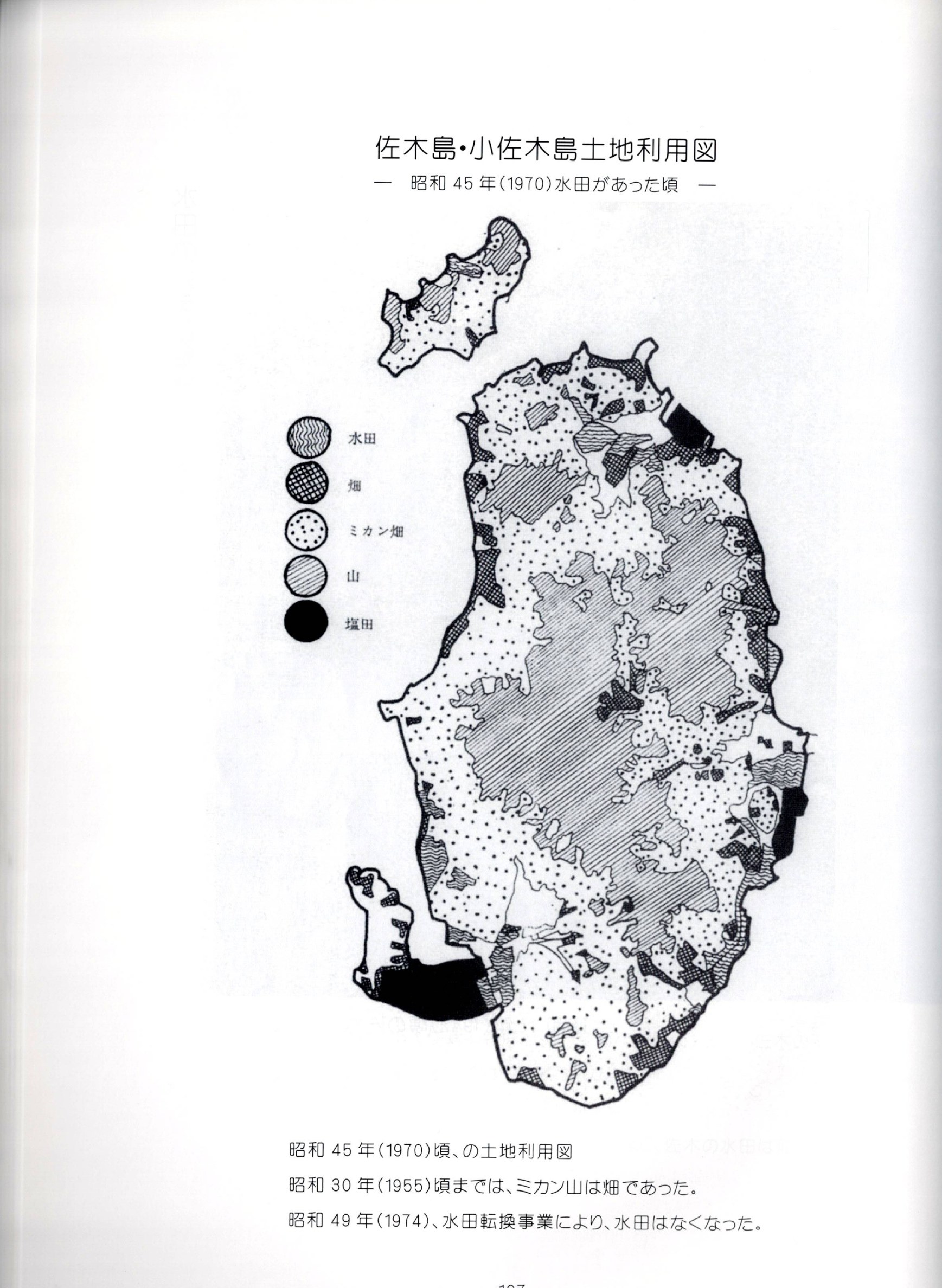
A hand-drawn land-use map from Sagishima Sanka, keyed to the island's land categories as they stood around 1970, before the 1971-74 paddy conversion (さぎしま讃歌 p.107).
『さぎしま讃歌』所収の手描きの土地利用図。1971〜74年の水田転換以前、昭和45年(1970年)頃の島の土地区分を示す(さぎしま讃歌 p.107)。
Representational anchor / 表現の参照点
The Sagishima Data Project references Hatsusaburo Yoshida (吉田初三郎), the 1924 panoramic bird's-eye-view cartographer, as a representational anchor for its digital-twin work. See Cartographers and The Digital Twin.
佐木島データ・プロジェクトは、デジタルツインの作業の表現上の参照点として、1924年のパノラマ的な鳥瞰図の地図作者である吉田初三郎を参照している。地図作者とデジタルツインを参照。
Open questions / 未解決の問い
- No single canonical base map yet ties the districts, ports, 88+α alcoves, and akiya into one reference. A candidate task for the Digital Twin. See open questions. 地区、港、88+α 御遍路の小祠、そして空き家を一つの参照にまとめる、正式なベースマップはまだ存在しない。デジタルツインの候補となる課題である。未解決の問いを参照。
Sources / 出典
- RDS Image Library; Sagishima Data Project page. See bibliography. RDS画像ライブラリ、佐木島データ・プロジェクトのページ。参考文献を参照。